
Lands Unknown
I am infatuated with antique maps of Old Canada, before the great eastern territories west of the Great Lakes to the Pacific Ocean were pioneered. These maps reveal the history of Canada from the emergence of New France into Canada West and Canada East, and into present Canada. There are hundreds of old maps available on line to view and purchase. Each, with great beauty, give insights into the views of the world at the time of their creation. Close inspection of the artistic details hidden in the maps are historical details. They are little vignettes of past life.
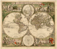
The magnificent Nova Orbis Tabula in Lucem Edita (New World Map Publication) by A. F. de Wit. of 1680 is very vague on the presence of Canada. It does contain magnificent comments on every day life - once you bypass the presence of cupids and goddesses. Please click here for more views and information.

Gerhardus Mercator's 1620
Map of the Americas is equally erroneous in it's guess of the Americas, giving it a rather bulbous grub-like shape. Please click here for details. Image provided by Antiquariat Reinhold Berg.
This 1681 Map of Northern America by Claude Bernou says it best - Canada - Terres Inconnues - Unknown Lands. Please click here for details.
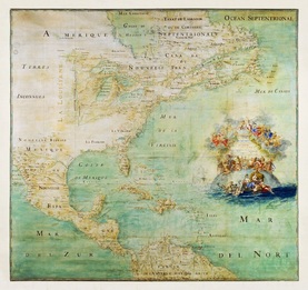

The magnificent Nicolas de Fer: Le Canada, ou Nouvelle France, la Floride, la Virginie, Pensilvanie, Caroline, (Paris 1702) from: L'Atlas curieux, ou la Monde, quatrième partie is a detail of historic New France - an eye opening display of the huge area monopolized by the King of France, and how easily the area could have emerged into a complete French-American entity, instead of the English-American area it is today. The minuscule British Colonies are engulfed and encompassed by the huge bulk of New France. I notice the "Acadie" is still a part of New France. Please click here for details.
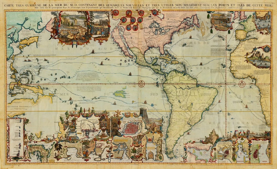
Curious indeed. Here is a truly amazing and elaborate map - the name is as engrossing as the map itself. By Henri Abraham Chatelain in 1719 the Carte Tres Curieuse de La Mer Du Sud. Contenant Des Remarques Nouvelles et Tres Utiles Non Seulement Sur les Ports et Iles De Cette Mer is loosely translated: "Very curious map of the South Sea which contains notes, new and very useful not only of ports but islands of this sea". Here there is still not a handle on the Scope of Canada and North America. But it does show beautiful detail of life at the time. Click here for details.
 RSS Feed