|
The Thomas Herse Maps
I love maps.
We are fortunate. There are numerous sites containing historical maps of Old Canada. In fact, the City of Kingston, Ontario has put together an amazing interactive atlas with which we can see how specific areas have changed over time. Another fabulous interactive map series is The Canadian County Atlas Digital Project. |
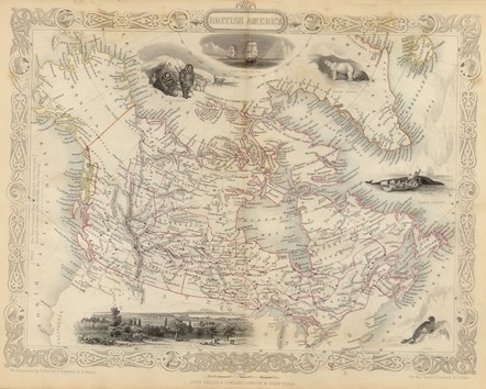
John Rapkin (1815-1876) drew and engraved a series of maps for John Tallis published for the 1851 London Exhibition . These maps are clear and detailed, and of much use for finding of long lost Ontario counties and townships. Sites which make use of the Rapkin maps include Wikipedia, Google, and various Canadian genealogical sites. Civil Engineer Justin O'Neil has contributed many well thought out and exact maps for Wikipedia. I highly appreciate his work.
So now, without further a-gab, let us look at some of these maps.
So now, without further a-gab, let us look at some of these maps.
|
Those of you with knowledge of Ontario Canada and Kawartha Lakes, Ontario must forgive those of us located great distances away. It is difficult to determine the whereabouts of certain locales, current and historic. A quick Google or Bing search does not easily show us what we need. For those of us who know only of Ontario, California here are a few self created maps showing the locales of Thomas Herse's Verulam and Thomas Albert Hersey's Kingston, Ontario. |
West Canada - Tallis 1851
drawn and engraved by J Rapkin
with my insertions of Verulam and Kingston

Victoria County
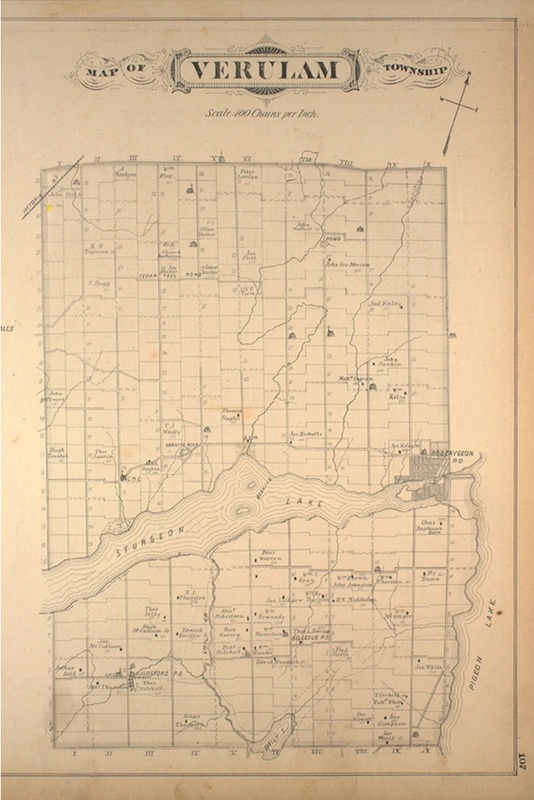
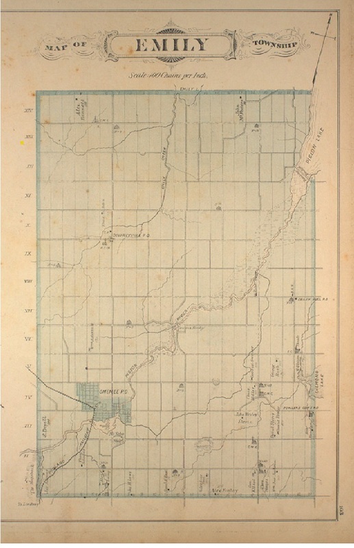
Below is a Tallis map of old Victoria County in which you can see Verulam (which looks to be misspelled) with Bobcaygeon and Emily, the township of The Herse's in 1861.

Verulam and Emily Townships
Accessing the Victoria map from the Canadian County Digital Atlas Website allows one to click on the individual townships of Verulam and Emily.
|
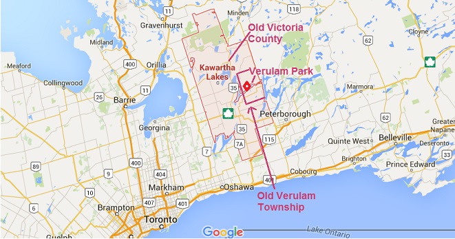
After investigation, we can see that the old Victoria County is roughly the area of today's Kawartha Lakes. A few Google Maps additions allow us to see this shift. With the visual aid of the Rapkin Maps, Google maps, the afore mentioned O'Neill, we can see the Victoria County, Kawartha Lakes transformation.
|
|
The above final colorful map is a surprising current map from Ontario Rentals, even including Fenelon Falls, the township of enumerator William Powells. It seems the old county still has a living presence in Kawartha Lakes, Ontario.